Archive for May, 2017

Whitehorse Yukon

Wednesday, May 31st, 2017
Minnie and me

Minnie and me

As I travel further north into the Yukon I can see the influence of the Native culture. This is the land of the Tlingit people. For centuries the Tlingit have hunted, fished and trapped the Northwood. When the white men came to this region they brought with them many diseases that the Natives had no immunity to. It kind of devistated their people for a while.

Nowhere is it more evident that I am in Native land than when I stop at stores and gas stations along the highway. The Walmart where I am camped tonight is staffed with mostly beautiful Native people. I’m sure there are many here that are the combination of different races as our world gets smaller.

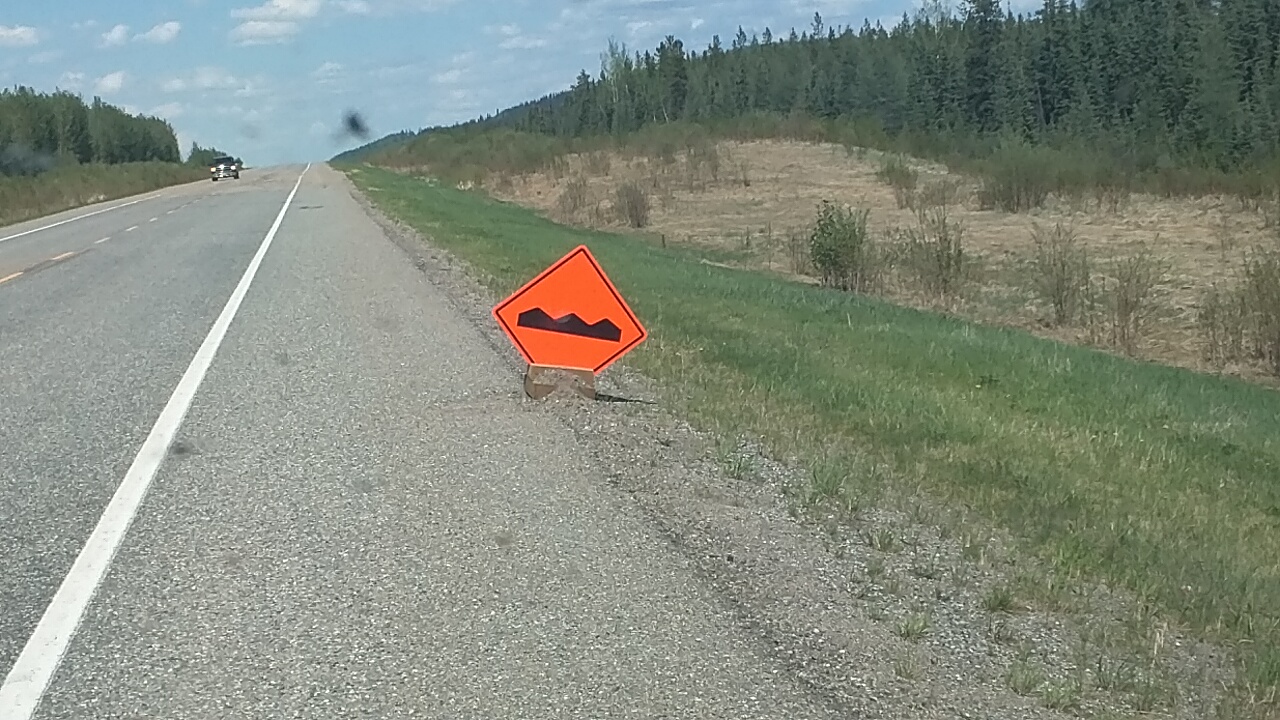
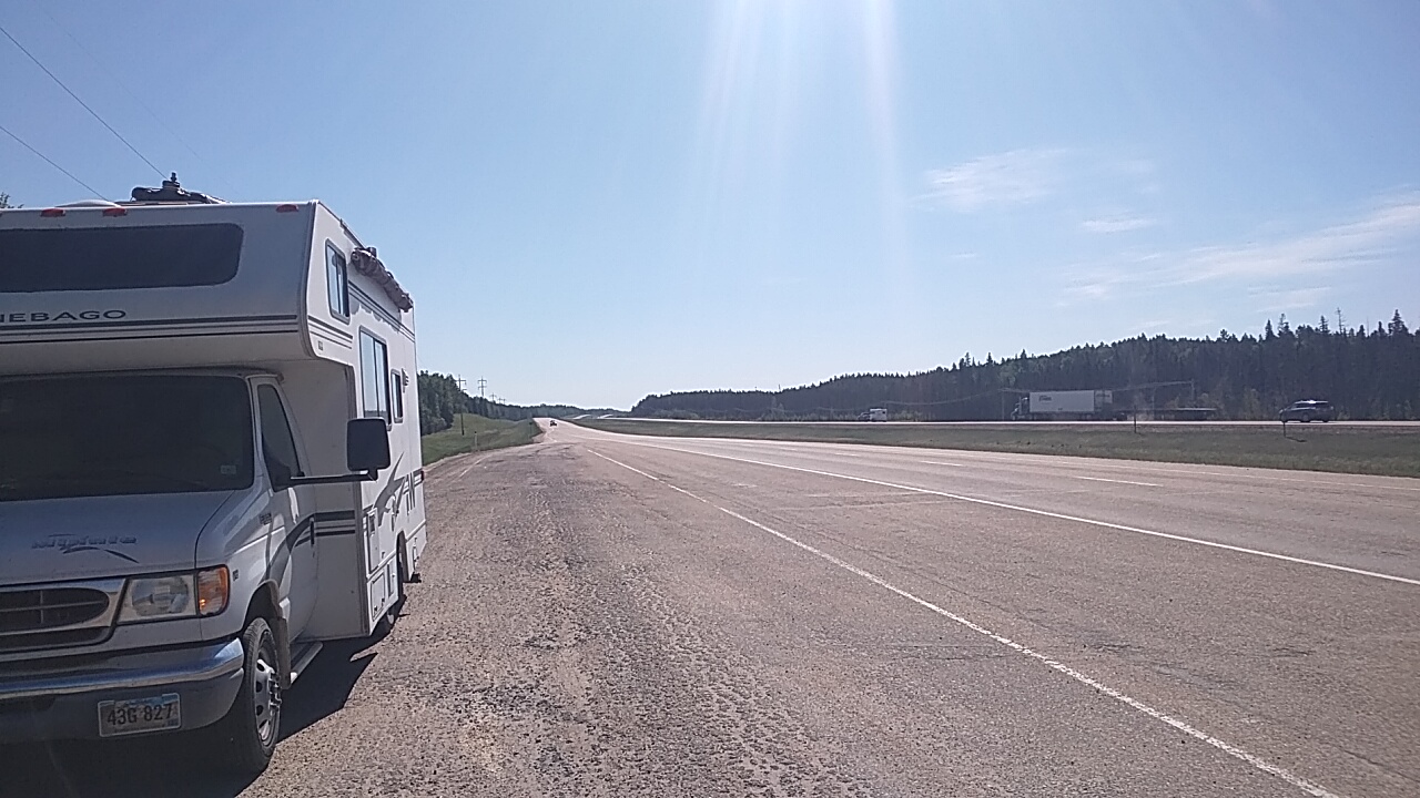
I made it to Whitehorse today. The highway is still in pretty good shape but there were several places where construction was underway. The road construction that makes the most mess of Minnie is when they take out the old road, grade a new subsurface of dirt, and then water it down to keep the dust from flying. The dust would be unsafe for visibility, but the watered down dirt makes mud that likes to coat the sides of Minnie and stick to Honda on the back.
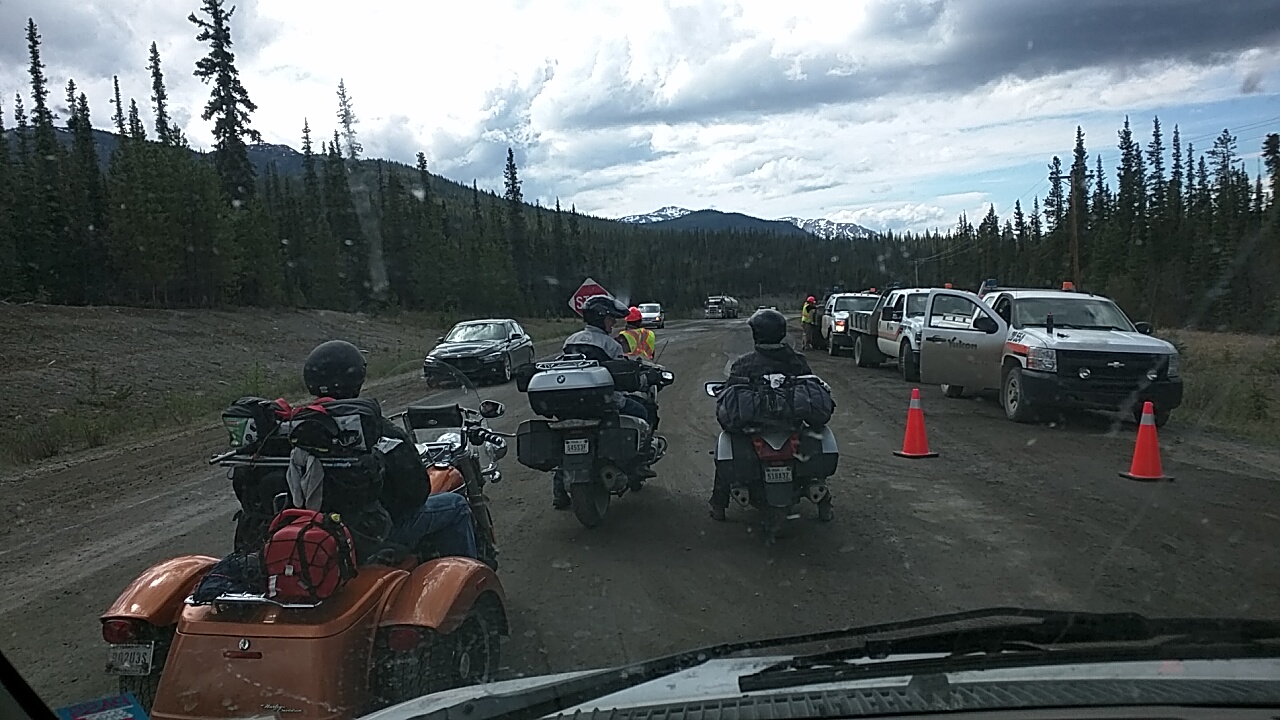
Construction

Construction

On one section of construction, one lane was blocked for several miles with a pilot car leading a string of vehicles through one at a time. I got there just at the end of line and had to wait 15 minutes for my turn.

I struck up a conversation with the Native girl working the Stop/Slow sign while I waited. I asked her about the road to Skagway and she said I would run into construction that way too unless I left at 6:00 am. Looks like I will hit construction. I told her I was very interested in the Gold Rush history of the area, and I don’t remember how we got to talking about it, but I mentioned I liked to watch the show Gold Rush on Discovery. She said she lives in Dawson City and sees many of the stars on the show. She told me that Parker, one of the stars that always acts so irritating and bullying on the show is actually a sweetheart. Ha!

I hope I can find a campground near Skagway. What I would like to do is unload Honda and see the area the easy way. My Milepost guidebook tells me the road to one of the campground is not recommended for motorhomes over 23′. I just make it in under that, so I will see.
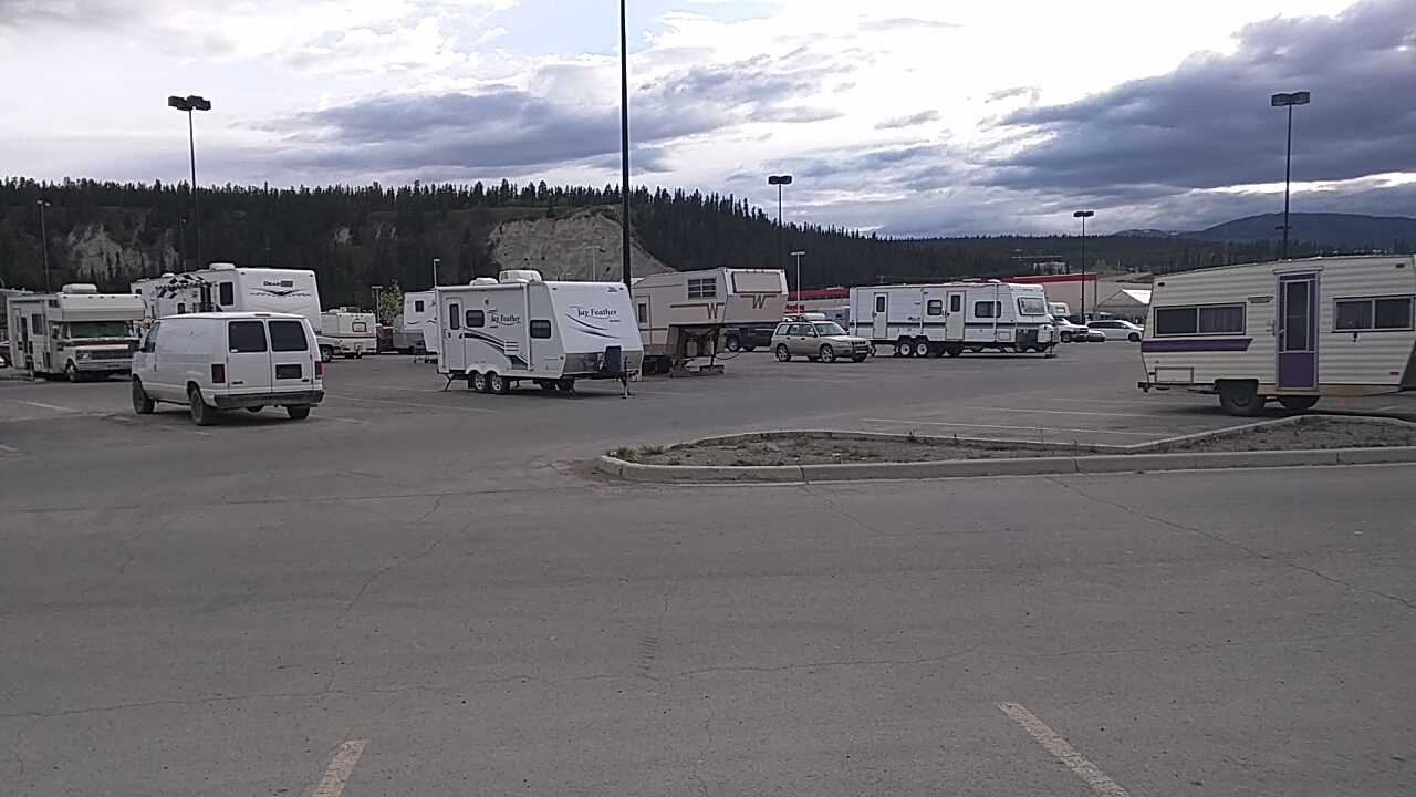
Whitehorse Walmart

Whitehorse Walmart

Signs

Wednesday, May 31st, 2017
Signpost Forest

Signpost Forest

Two silly traditions along the Alaskan Highway in Watson Lake an beyond are the Signpost Forest and Rock Signs. The Signpost Forest has thousands of signs nailed to wooden posts over the last few years. Many of the signs are homemade and others just highway markers. A lot of the signs depict a travelers information as a kind of memorial to say they were here.

North of Watson Lake the traveler can see many names and messages made with rocks along the shoulder of the road. I guess the pilgrimage to Alaska brings out the desire to leave your mark along the trail – like a type of petroglyph or graffiti to future generations.

I spent the night at a big turnout somewhere between Watson Lake and Teslin, Yukon. I may have been back in British Columbia because the road dips back south for a bit. There is not much to tell about the drive yesterday afternoon and this morning. I have dropped back out of the mountains into rolling hills, lakes, and rivers. I can see snow capped mountains up ahead. I should be near Whitehorse tonight.

Bears!!!

Tuesday, May 30th, 2017
Big boy!

Big boy!

Today was a wildlife day. Shortly before I reached Fort Nelson I saw a black spot up ahead beside the road. I knew immediately that it was a bear, so I stopped and took a few pictures. He seemed not the least bit frightened at Minnie parked a few yards away and continued to munch the new grass along the shoulder. All in all I would see 5 more bears in the miles past Fort Nelson. The last one was a full grown beauty that must have weighed 500 pounds (or 226kg because he lives in Canada).

Stone Sheep

Stone Sheep

I entered the mountains today. The road became quite rough, narrow, and curvy so I didn’t make very good time. I passed by Summit Lake that was still completely frozen over with patches of snow along its banks. A mile later I stopped in the road to watch several Stone Sheep licking the edge of the shoulder. I think they like the salt left over from winter treatment of the highway.

I crossed numerous rivers. So many rivers to cross is what gave the early builders of the Alaskan Highway fits. All the early bridges constructed by the military were made of wood and most of them washed away in heavy floods. They are all replaced now with solid steel and concrete structures.

The highway passes by Muncho Lake for seven miles. This was another stretch of highway that gave the early military builders headaches. The highway was eventually rerouted, but one local told me that several machines went over the edge into the deep lake where they remain today.

I took quite a few breaks from driving today. With the twisting road, I couldn’t use cruise control and my leg got tired. It was 3:30 by the time I reached my destination for the night – Liard River Hot Springs Provential Park. They charge $26, have no hookups, not even a dump station, no wifi, but they have a hot spring you can go soak in, and that’s the main thing. I may go soak again in the morning before I leave.

The Alaska Highway

Monday, May 29th, 2017
Mile zero

Mile zero

I left Grande Prairie quite early and drove to Dawson Creek, mile zero of the Alaskan Highway. I took all the obligatory pictures of the sign post, looked around in the museum, and watched the movie of the construction of the highway back in the early 40’s. I hadn’t pictured Dawson Creek as so large. In my mind I thought it was a small town, but it is really quite a large city with all the big box stores and fast food. I may have purchased a coffee at Tim Hortons.

I was not impressed with the highway north out of Dawson Creek. All along the road for a hundred miles is gas and oil industry. Every side road I looked up had cleared out areas of pipes and tanks and buildings. I think I read in the Milepost where taxes from the gas and oil industry are helping to fund the Alaskan Highway. The industry must be booming because there were even signs up asking for workers for the oil fields.

IMG_20170528_092155

Because it was Sunday I figured there wouldn’t be much truck traffic. I was wrong! Semi trucks carrying pipes, tanks and machinery were the majority of vehicles on the road. There must be good money to keep those trucks rolling 7 days a week. And the drivers have no patience for us vacationing RVers driving the speed limit.

The road crossed the Peace River shortly north of Dawson and I got my first taste of 8 and 10 degree hills. I wanted to take a picture of the grated bridge but there was no place to pull off. After about a hundred miles, the oil fields thinned out and I met few trucks.

I put a few liters of gas in Minnie at a campground near Pink Mountain. The gas cost $1.30/liter but I wanted to make sure I had enough to reach Fort Nelson tomorrow. It is a sinking feeling to be on this desolate highway and be low on gas.

Road Sign

Road Sign

The road keeps getting rougher the further I go. I lost the divided highway a few miles past Grande Prairie. Now I have to rely on turnouts and passing lanes to let the locals get by. They put up little signs by the road that look like bumps to let you know if the road is bad up ahead. It seems to me that the regular road is just as bad as the signed places but I slow down anyway.

I found a side road at about milepost 200 where I will spend the night. I can see snow covered mountains off to my left, so it won’t be long now until I’m in them. The weather has been beautiful – sunshine, light winds, and perfect temperatures. With the good weather and sparce traffic, once I got past the oil fields, I kept going further than I like. I hope I find a campsite soon where I can take a few days to rest.

Hard to see Moose.

Hard to see Moose.


On a good note, I saw three moose today munching on bushes along the side of the highway. They are fun to look at but nothing you want to run into. They are a big animal.

Trees!

Saturday, May 27th, 2017
Roadside turnout.

Roadside turnout.

Tonight we are in Grande Prairie, Alberta at yet another Walmart. I was going to stay at a campground or RV park to fill and dump, but I found a rest area with a free dump so there is no need to pay to park tonight. This Walmart has a small parking lot with limited room to stay out of the way, but it will do for one night.

When I left Edmonton I drove within a couple miles of the largest mall in the universe. From what I hear it is a veritable Disneyland of stores and attractions. If I had a female traveling with me or some teenagers, I would probably have to check it out. I didn’t think I needed anything and man-made attractions are not why I’m doing this trip so I went on by.

The terrain on the drive up here was nice. After I drove a few miles past Edmonton, it changed to trees and rolling hills. There was less traffic and the whole way was on divided highway. Canada seems to be very clean. The highway sides don’t have a lot of trash and it looks like they keep the grass trimmed. They have a lot of what they call “roadside turnouts” which are nothing more than a pullout along the road with several trash bins. Maybe that is why the roads are so clean.

I got gas again here in Grande Prairie. I was getting pretty low by the time I got here and $100 have me 3/4 of a tank. This trip is going to be expensive! Tomorrow I should be in Dawson Creek and the start of the Alaskan Highway. I have a map that is almost three feet square, portraying Alberta, British Columbia, Yukon, and Alaska. Of the two feet from the border of Canada to the middle of Alaska, I have done 4″. It is a long drive to see some pretty mountains.