Picket Post

March 19th, 2014

3/16/14 – 301 miles

Tired Hiker

Tired Hiker


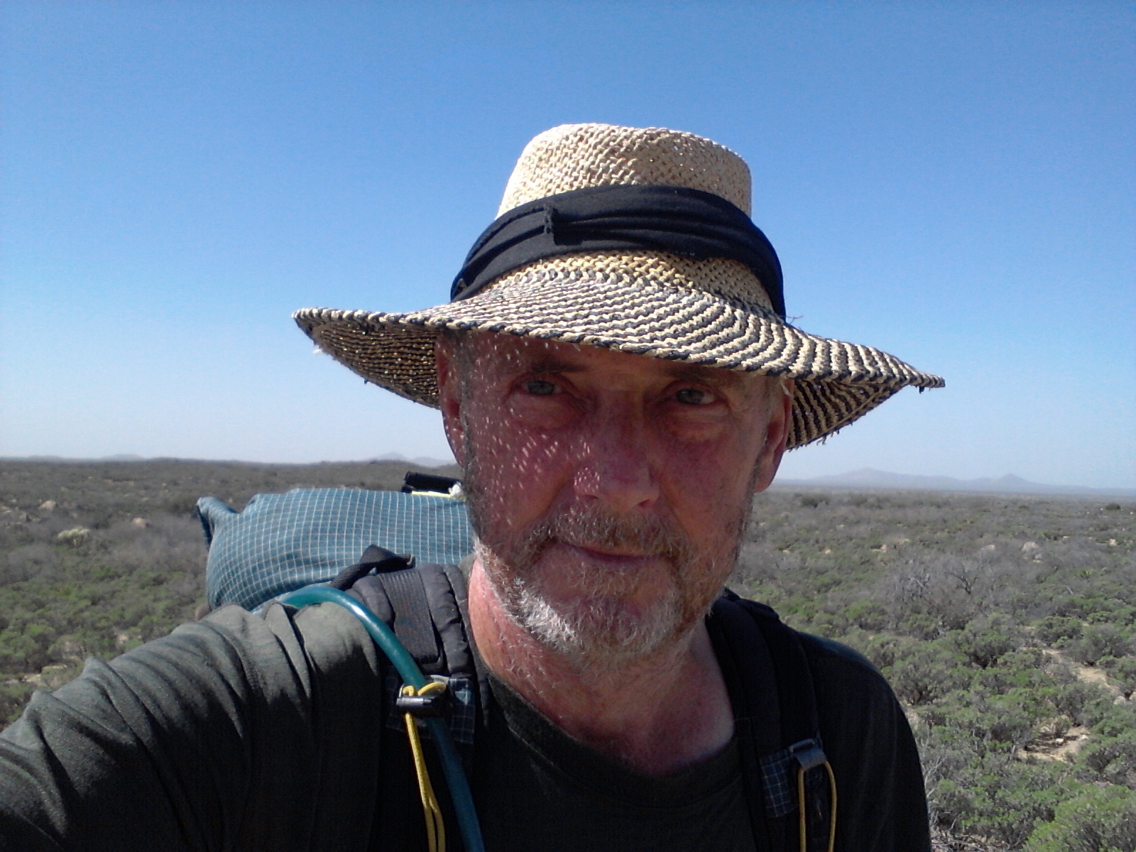
I was up early and on the trail by first light, confident that I could reach the end of my section hike and fall back into the real world of beds and greasy food. It wasn’t so much that I was tired of hiking, although I had developed a couple of blisters, but that my body was ready for a rest. It had been six days on the trail with very little water to spare and food supplies running low, and the longest stretch of my hiking career without seeing a soul. I vowed to enjoy the day and not waste the beauty of this section by focusing only on getting done. But when your foot hurts, the pack seems way heavier than it ever did before, you smell somewhat worse than a billy goat, and you are partially dehydrated from not drinking enough liquid, it’s hard not to think only of the end.

The section above the Gila River really was beautiful. The trail winds up into high canyon cliffs with views for miles in several directions. There were awesome formations of jutting rocks and buttes that gave the area an almost other-worldly appearance. The canyon is so remote and isolated that few people ever get to see it. It was quite a taxing climb up and out of the section, and I have to admit I was a little discouraged that what appeared to be the top only wound around more formations and dropped me down through another ravine and back up again, but the sights made it bearable. I finally was able to get a cell signal and give Richard the heads up that I would arrive at the end that afternoon. From that point on I was down behind mountains and would not have another chance to update my eta.

It was a lot easier walking when I entered the last section and I made good time to a place called Trough Springs. I was really thirsty by that time and needed water badly. Trough Springs is a place I have been to before. When Daryl, Donna, and I did a short backpack trip a few years ago we chose a route that let us camp near the spring on the night of our trip. When we camped there a few years ago the spring was full with good water, but when I arrived this time the trough had about one inch of disgusting slime in the bottom. This was bad news. I had another 8 miles to hike and I was not looking forward to going that distance without water.

After some investigation I found a 24 inch round pipe sticking out of the ground above the cattle trough and went to check it out. When I removed the cover and peered down into the well I could see water about 8 feet down. At first I thought there was no way I would ever be able to get to the water, but with a little ingenuity I fashioned a bottle tied to a long stick and was able to dip water from the well. I left the stick and twine I used to tie on the bottle in hopes that the next hiker would be able to “fish” the same way I did.

When I arrived ad Picket Post Trailhead, I finally got a text to go through to Richard and Dianna and they were there shortly to pick me up. Someone had left several gallons of water beside the trail and I used some for washing up a bit. I know it was for drinking but every thruhiker will go into town when they get there and not be as affected by their water supply.

Most of the AZT was marked well and easy to follow. There were a couple of places where the markers were missing and the trail somewhat unclear where it went, but most of the way was easy to follow. I will probably send out a note to the Trail Conference telling them where I was confused and on one instance lost for a few miles. I used only the guide book for navigation and I would suggest getting the route on GPS along with detailed maps showing all distances and water sources. Each item you use for navigation and information cost more money – which I was reluctant to spend – but probably would be worth it in the long run. I’m glad I took a water filter because a lot of the water sources are stagnate ponds. Even though you can make water safe to drink with chemicals it is nice to run it through a filter to remove all the gunk floating around in it.

It was a good hike:
– On the AT I never had to worry much about water.
– On the AZT I never had to worry much about rain.

– On the AT the trail was almost always in the shade.
– On the AZT I could almost always get a good charge on my solar panel.

– On the AT someone was always around in case you were hurt or sick or just wanted company.
– On the AZT you could be alone and enjoy the solitude of being one with nature.

– On the AT it is easier to hitch into town from the trail.
– On the AZT I had two wonderful trail angels following me all the way.
Godzilla!

March 16th, 2014

3/15/14 – 284 miles.

Gila Monster

Gila Monster


In some sections of the trail industrious builders have created giant, stone cairns to mark the path. Some of them were waist high and one was almost to my shoulders. Every time I would pass one a little lizard would run to the top of the cairn, taking up a post like a guard in the watchtower, then diving to the safety of the rocks as I came close. I have seen hundreds of these little guys, but I was not expecting to see the big guy I came across this morning.

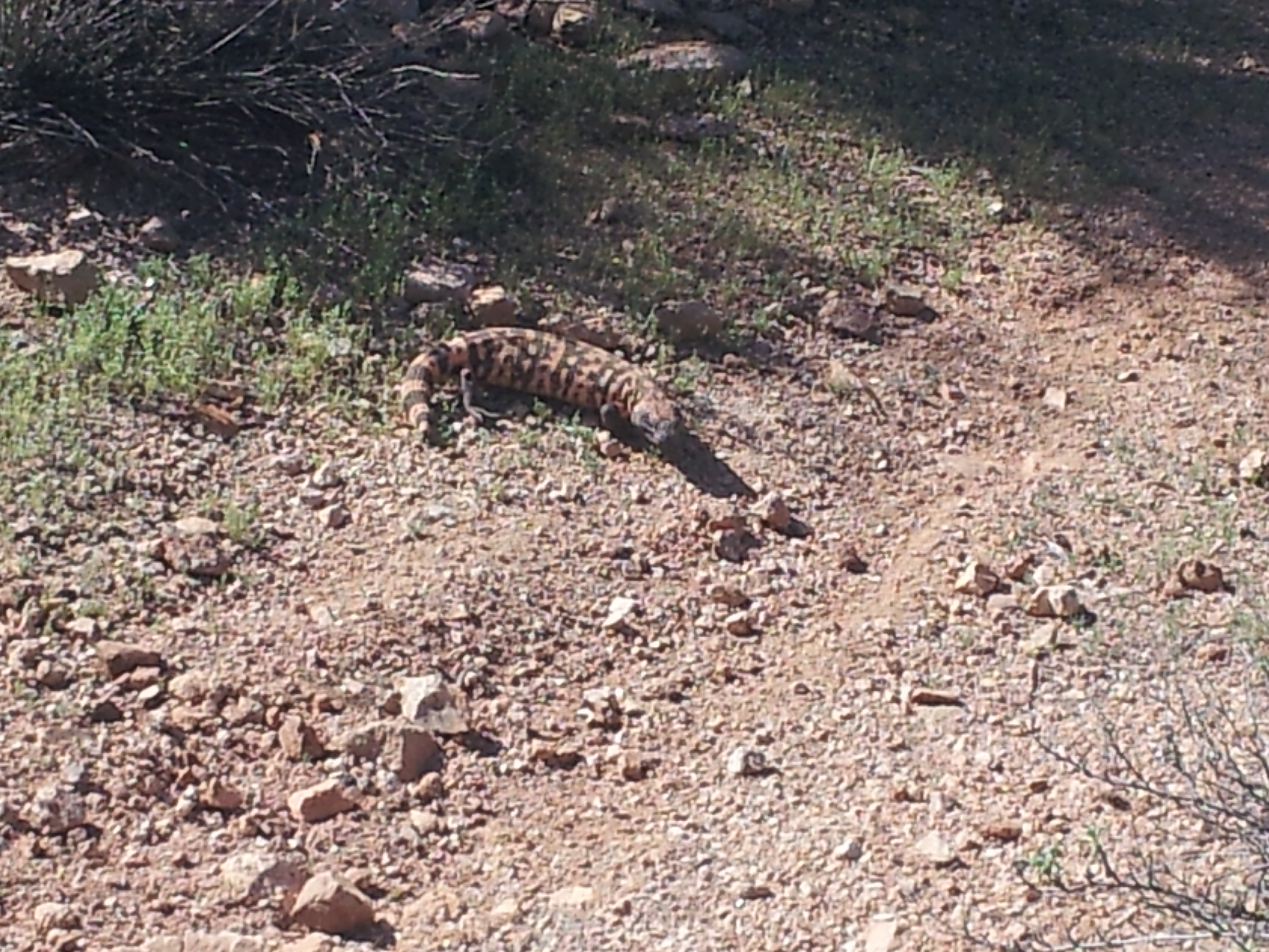
I spent most of the day walking beside the Gila River. The trail would climb up to the high ridge above the valley and give splended views, then descend into the flat land of mesquite forests with camping available everywhere. It was on one of the ridges when I rounded a switchback and came face to face with a Gila Monster. He was not friendly at all. He would open his mouth and hiss at me, as if to say: Get off my trail! I got off the trail and went around.

So I can add one more critter to my list. He did let me take a couple of pictures from a distance. I guess it is only logical to see a Gila Monster beside the Gila River. My book says there are mountain lions and bighorn sheep in this area. I would love to see a bighorn.

The trail left the river and wound up through a canyon. I stopped after a few miles of climbing and made camp in a wash. I should make it to Picket Post tomorrow. I hope I can get a signal and secure a ride.

Snakes and Scorpions

March 14th, 2014

3/14/14 – 267 miles.
I never did find the water tank that was mentioned in my guide. It was only 90 feet off the trail so it seems funny that I missed it. All the AZT signs say not to rely on cow tanks – they are the property of the ranchers and you are supposed to get permission to even use them.

I started out early while it was cool and rationed what remaining water I had left. The flat desert soon changed to canyons and tall hills. It was a lot prettier to walk through but the climbs made me more thirsty. I arrived at Florence – Kelvin Highway -where there is a water cashe – about noon and drank a half-gallon of water before filling up my bottles and moving on.

This next stretch follows the Gila River for 16 miles so I will have water for a while. The trouble with the Gila is that it is muddy. I filled my bottles and will let them sit overnight to see if any of the mud will settle before running it through my filter.

I have seen 4 snakes, countless deer, 1 wild pig, jackrabbits, 1 mountain lion, 1 scorpion, 1 turtle, and hundreds of cows. None of the snakes were venomous, I squished the scorpion, and everything else ran away.

The cows that are pastured in the desert sometimes make a mess of the trail. They are forever making their own path and breaking down the edges of the trail. And they cut switchbacks all the time. They think the shortest distance is the best route.

Temporarily Lost

March 14th, 2014

3/13/14 – 253 miles.
Today was a crazy day. I had planned on hiking 20 miles today so that I would reach the next water tank by evening. I made it to the Freeman Road water cashe about 8:30 this morning and the next water was 18 miles up the trail. I figured 20 miles over relatively level ground was doable so I filled my bottles and started out. I would have been fine if I hadn’t gotten lost.

Getting lost is unsettling enough but getting lost when you are low on water is frightening. The trail followed a powerline for a few miles and I made good time to a side road that was only marked with a stick. I finally figured out that I was supposed to go that way and I followed cairns for a mile or so. Then I came to an area where ATVs had cut through and made a mess of the trail. Somehow I got on one of the ATVs tracks and followed it out to the powerline again. Even though it didn’t seem right my GPS said I was on the trail. I must have gone three miles down the powerline before I was sure something was wrong and turned around. Once I got back to the end of the ATV tracks I found where I should have turned off.

I hiked until almost 6 trying to find the water tank but I had to stop and make camp before dark. I have no idea how far I am. I hope the tank is near and I will find it early.

More Desert

March 13th, 2014

3/12/14 – 233 miles.
Thank goodness for ranchers that have cow tanks along the trail. This section is so dry that without the occasional tank, you would have to cashe all water along this part of the trail. I found three gallons by the trail this morning with a message saying they were for backpackers on 2/22, which was two weeks ago. I didn’t need any water as I had filled up earlier at Mountain View Tank.

I haven’t seen anyone since I left Oracle. There were a lot of ants on the trail and I found myself stopping to watch them work. They didn’t seem interested in foraging away from the nest, just all carrying a piece of sand from their hole and then scurrying back down again. Maybe they are home builders. Maybe it says something about me because I would stand there and watch ants.

With all the cactus through this area, sometimes the only place to set up my tent is in a wash. The only problem with that is getting my stakes to hold in the sand. As I write this, sitting above my camp on a rock, a jackrabbit has come out and is nibbling grass. He is getting awfully close to my tent so I think I will make a noise.